
From Bozok to a Modern Capital: the Long Journey Astana has Made Thus Far

Moreover, I aim to provide some interesting details on how Kazakhstan relocated its capital and many other details. The first says that the city of Akmola was named after a limestone hill of white color. The second version belongs to the Byzantine author Procopius. He wrote in his writings that the Huns called the "mole" a high hill or fortress. And the third option: Akmola has always been the main center of the cattle fairs, known for the abundance and variety of meat and milk products (koumiss, ayran, kurt, shubat, etc.). Therefore, the name of the city is translated as a "white holy place" or "white abundance".
In the Kazakh Soviet Encyclopedia, it is written "Akmola is a building made of white stone, above the quadrangular walls of which there is a dome resembling the upper part of the yurt or half of the ball. The dome that glittered in the sun was visible from afar, which gave a special beauty to the banks of the Yesil River. " Therefore, the name of Akmola became the name of this region.
Stages of Akmola since ancient times were a place where different cultures and civilizations met. In the middle of the first millennium BC, the historian Herodotus mentioned the route through the Great Steppe (later the Great Silk Road), which ran here. Caravan routes promoted the flourishing of trade and handicrafts in cities traditionally occupied by livestock and agriculture.
.jpg)
In his book "In the Heart of Eurasia" the President of Kazakhstan Nursultan Nazarbayev noted that the present capital of Kazakhstan originated not in an empty place, but in a territory inhabited by man in ancient times. This is confirmed by the recent discovery of the medieval town of Bozok, which for a number of centuries was the political and spiritual center of Sary-Arka - a great and boundless steppe, stretching for thousands of kilometers in the center of the continent, called Eurasia. The medieval settlement of Bozok, located five kilometers from Astana, is a thousand-year predecessor of the Kazakh capital.
During the 1930's. in the steppes of Kazakhstan at the site of the village of Akmola emerged the city of Akmolinsk - an important commercial and economic center of the Central Asian region. At that time, its population estimated a little more than 2000 people. However, over the next 30 years, the city's population has increased three times.
A new stage in the life of the city began in the 60s of the last century: in December 1960 a city with a population of one hundred thousand became the center of Celina in northern Kazakhstan. In 1961 Akmolinsk was renamed to Tselinograd, in 1992 - to Akmola, and on May 6, 1998 - to the city of Astana.
.jpg)
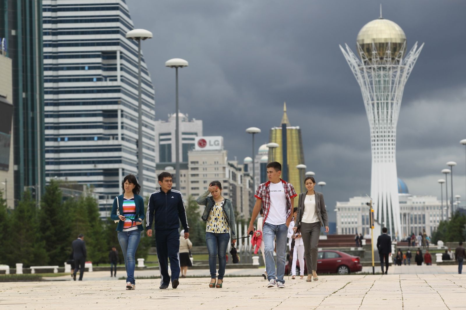
From Almaty to Astana
In the last decade of the 20th century, the city of virgin lands found a new breath - with the advent of the ancient steppes of Akmola on the world map of the Republic of Kazakhstan, where the miraculous city of Astana appeared.
Astana became the capital of new Kazakhstan for many reasons. The former capital - Almaty - was located far in the south of the country, and its population was over 1.5 million people. Dense construction of Almaty actually left no room for the development of the city. Transport loading of highways and ecological conditions of the "Southern Capital" left much to be desired - it became one of the most environmentally problematic cities in Kazakhstan.
In recent history, cases, where the transfer of the capital is carried out consciously as an adequate response to new challenges of history, are not uncommon. This gives a powerful impetus to the socio-economic and political development of the country. The states that carried out major reforms, which led the country to a qualitatively new level of development, widely used the transfer of the capital as the most important political and economic tool, a strategic point for implementing the reform program. The new largest Eurasian power needed a new national symbol - a new capital, a city of the 21st century that would reflect the spirit of creation, innovation and the role of Kazakhstan as a place where the West meets the East.
.jpg)
That is why, at the suggestion of the President of Kazakhstan N. Nazarbayev, Akmola (Astana) was chosen as the best alternative to Almaty. The President's opinion was based on a nationwide study that took into account 32 factors: socio-economic indices, climate, landscape, seismic conditions, natural environment, transport infrastructure, construction facilities and labor.
The decisive advantages in favor of Astana were: its large territory, central location, proximity to the main economic centers and arteries of the country, demographic potential, developed transport infrastructure and natural environment. In general, the idea of the Head of State to move the capital was a deeply justified and objectively necessary decision that, along with economic reforms, was another strategic mechanism for solving the tasks of Kazakhstan's development, the country's transition to a market economy and democracy.
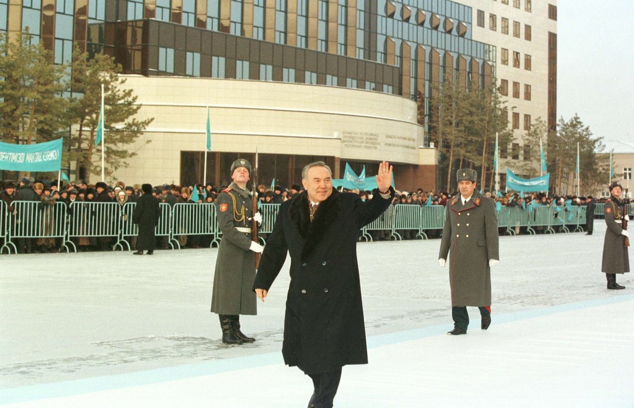
In 1999, the new capital of Kazakhstan was awarded the UNESCO Prize "Cities for Peace". It is an award to the cities that have most successfully proved themselves in the social, environmental, municipal development sectors and make a practical contribution to the culture of peace. Presenting the award, the Director-General of UNESCO, Mr. Federico Mayor, emphasized that in a short time since the transfer of the capital from Almaty to Astana, the President of the Republic of Kazakhstan Nursultan Nazarbayev and the city municipality made great efforts to turn the new state capital into a center of science, culture, and education. According to the head of UNESCO, Astana has become a bright symbol of the independence of the young state.
With the acquisition of Astana as the capital in 1998, the ancient city of masters, traders and grain growers became the center of the state, public and cultural life of the new, democratic Kazakhstan. Astana is the pride of the Republic, its people, and the President, who in his conversation with journalists noted: "The plans are very large. I believe that the main construction of the city will be completed by 2012. The city will live its own life, and its growth will never stop."
The medieval city of Bozok - the predecessor of Astana
The bogs were opened by the Kazakh archaeological expedition under the leadership of the well-known historian, honored figure of Kazakhstan Kemal Akishev in the fall of 1998, and in the following year excavations of the ancient settlement began.
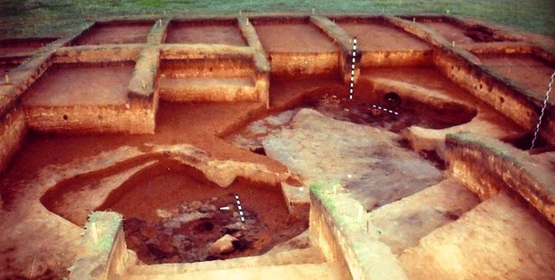
The ruins of the ancient center of civilization were found on the eastern shore of Lake Buzukta, five kilometers from modern Astana.
The Bozok is a completely unusual type of medieval settled settlement - it consists of three separate parts. Central - this is a neighborhood, surrounded by a moat and a rampart. In the northern part there are residential and industrial buildings, and in the south, there is a necropolis. Having studied the layout of the first houses found, Professor Kemal Akishev supposedly established the date of their construction - VII-VIII century.
The ruins of the monument have a typical steppe appearance. Low shafts (0.6-1.0 m) surround flat surfaces of squares of a square shape. The configuration of the sites is clearly distinguished by internal ditches. In the ditches, jumper passages are fixed. People who chose this place for settlement built three sites - "quarters" (50x50 m) of a square shape, surrounded by moats and adobe walls. During the years of excavations, the architecture of these defensive fortifications has been explored. According to written sources, it is known that the nomads strengthened defensive fortifications, stacking carts at the top of the shaft. They could be hidden behind the defenders of the fortress.
After studying the findings, archaeologists recognized that the monument was unique. The central and northern parts of the country have been little studied, and therefore for the northern steppes of Kazakhstan Bozok is an amazing and unique find for historians.
After the foundation of the village of Bozok, centuries passed. This place was left by his first settlers. The second stage in the history of Bozok falls on the period of strengthening in the steppes of Kazakhstan the Kipchak Khanate (10th-11th centuries). The new inhabitants cleared the moats, poured clay into the inner areas, built land houses of clay bricks and wood on them. In the center of the grounds, there were yurts. Their bases were discovered in the process of excavation. Kipchaks poured the space between the sites ("quarters"), raised it and on its surface built the first mausoleums and minaret. In this, there is nothing surprising. In ancient times, cities in the steppes formed around sacred places, around the graves of their ancestors.
.jpg)
The third stage of the development of this place begins in the Golden Horde period (XIII-XIV centuries) and continues until the new time. The ruins of the town of Bozok acquire the status of a cult center. Perhaps, one of the first Muslim missionaries was buried here, the grave of which became a shrine. The ruins of five mausoleums constructed from raw and burnt bricks were studied at the site of the town of Bozok. Near the mausoleums are open bricks.
Altogether 49 graves of the 10th-14th centuries were excavated on the territory of the site. This is the first such representative collection of anthropological material collected on the territory of one monument. Studying it can shed light on the problem of ethnogenesis of Kazakhs. A third of the burials are with things or with sacrificial food. Two-thirds are performed according to the Muslim rite. In the material culture, a group of burials of the 13th-14th centuries is distinguished. In this regard, the problem of the spread of Islam in the steppes of Kazakhstan is of interest. Despite the adoption of the Golden Horde in the XIV century. Islam as a state religion, in the deep steppe regions of Kazakhstan, they continued to bury on pagan rites: in clothes, with things, with requiem food; there are skulls, scapulas, dismembered carcasses of horses, whole skeletons of sheep. The dating material is represented by iron arrowheads, a bronze mirror, a silver coin, a silver cup, ornaments. At a later time, perhaps (XVI-XVIII centuries.) Here were buried on the Muslim rite: without things, head to the west, face to the south, in graves with blunders.
.jpg)
Unexpected discoveries
The most unexpected finds of archaeologists were fragments of irrigation structures, adjacent to the ruins of the city on the east side. Around the settlement, the residents planted vegetable gardens and crops, creating a well-designed system of irrigation facilities. The irrigation system was discovered accidentally in 2000 when the summer was so rainy that moisture did not have time to soak into the soil. Walking once through the territory of the archaeological camp, the head of the expedition K. Akishev, saw that the water, gathering in separate streams, flows down towards the lake. So the arches, built by the inhabitants of the medieval town of Bozok, were discovered. The territory of the irrigation system and the ruins of the city as a whole occupy an area of about 30 hectares.
Until recently there was an opinion that nomads did not have stationary habitats, and continuously moved across the steppe, the discovery of the medieval town of Bozok was of great importance in terms of confirming the hypothesis of the presence of sedentary tribes in the steppe spaces of ancient Kazakhstan. And already in the Middle Ages, when the Kipchaks (nomads) entered the political arena, there were cities and settlements.
The settlement of Bozok, or as it was originally called - Buzok (Buzuk), has survived and survived to this day only due to the fact that it is located among the marshes of the left-bank valley of Ishim. But now, according to the general plan for the development of the capital, Lake Buzukta and the ruins of the medieval city are included in the district ring of the city.
Kemal Akishev said that the preservation of this archaeological monument is one of the important tasks facing the state, at a meeting with the President of the country, which took place not long before the death of the scientist. The archaeologist initiated the creation of a museum-reserve on the territory adjacent to Bozok.
Bozok - an archaeological phenomenon
Initially, Akishev called the open city Akzhol - a bright path. Later, having worked a number of written sources on the history of Oguz Turks and found in them the toponym of Buzukta, preserved in the name of the lake, he renamed his offspring in Buzuk. In the process of discussing the meaning invested in the name of the locality, the President of Kazakhstan and Kemal Akishev came to the opinion that the name of Bozok - a light arrow - would be the optimally acceptable name for the archaeological phenomenon.

In this ancient Türkic word, a great meaning is hidden - it represents the desire of the bellicose Turkic tribes to advance westward. In 2004, an international scientific conference was held in the field camp of archaeologists directly on the territory of the town of Bozok, in the work of which experts in the study of the steppe civilization - prominent archaeologists of Kazakhstan and Russia - participated. After examining the excavations, having got acquainted with the material - ceramics, metal, bone products, they came to the conclusion that an urban settlement appeared here in the 10th-12th centuries.
The historical name of the city, which we now call Bozok, we do not yet know. But right now it is absolutely certain that it was the center of administrative power, the point of concentration of crafts and trade, including international because it was at the intersection of various branches of the Great Silk Road. They were part of its general system and connected the steppe Sarah-Arka with a zone of urban civilization that was intensively developing in the south of Kazakhstan and in Zhetysu.
Through the Silk Road, Bozok was associated with Europe, China, the countries of the Arab East. Saryarka, receiving prestigious goods, cultural standards and new technologies from neighboring countries, was also a center for the production of metal products, which Central Kazakhstan was famous for throughout the Eurasian continent even in the Bronze Age. Products from metals spread west to the Balkans and to the east - to Xinjiang. In the early stages of the existence of Bozok, the metal, which was exported from the Sary Arka, in particular, the development of silver, is described by the Arab geographer al-Idris. But many achievements of Sara-Arka - high-breed horses, leather goods, wool - were exported to the near and far regions of Eurasia along the same Great Silk Road
.jpg)
Thus, starting from the era of antiquity, the Nura-Ishim interfluve was the most important economic center. At the same time here were located the residences of the steppe lords. One of them is the Bozok - the forerunner of modern Astana.
Since the end of the XIX century, after gaining the status of the city, Akmolinsk began to develop according to the general plan and strictly approved projects. So, creating the projects of a new city at the turn of the XIX-XX centuries, architects and environmentalists were guided by the general idea - the city should become a green oasis. The idea of creating a garden city in the steppes of Sary-Arka was based on the traditions of planned settlement based on the principle of internal regionalization, widespread in Western European cities from the middle of the XIX century.
At the end of the XIX century, when the provincial Akmolinsk officially received the status of the city, in accordance with the General Plan, the first city park was laid, a forest nursery was broken up and a green zone along the Ishim riverbank began to form. In 1904, artificial green plantations were planted on the outskirts of Akmolinsk. Despite the pessimistic forecasts, young seedlings took root.
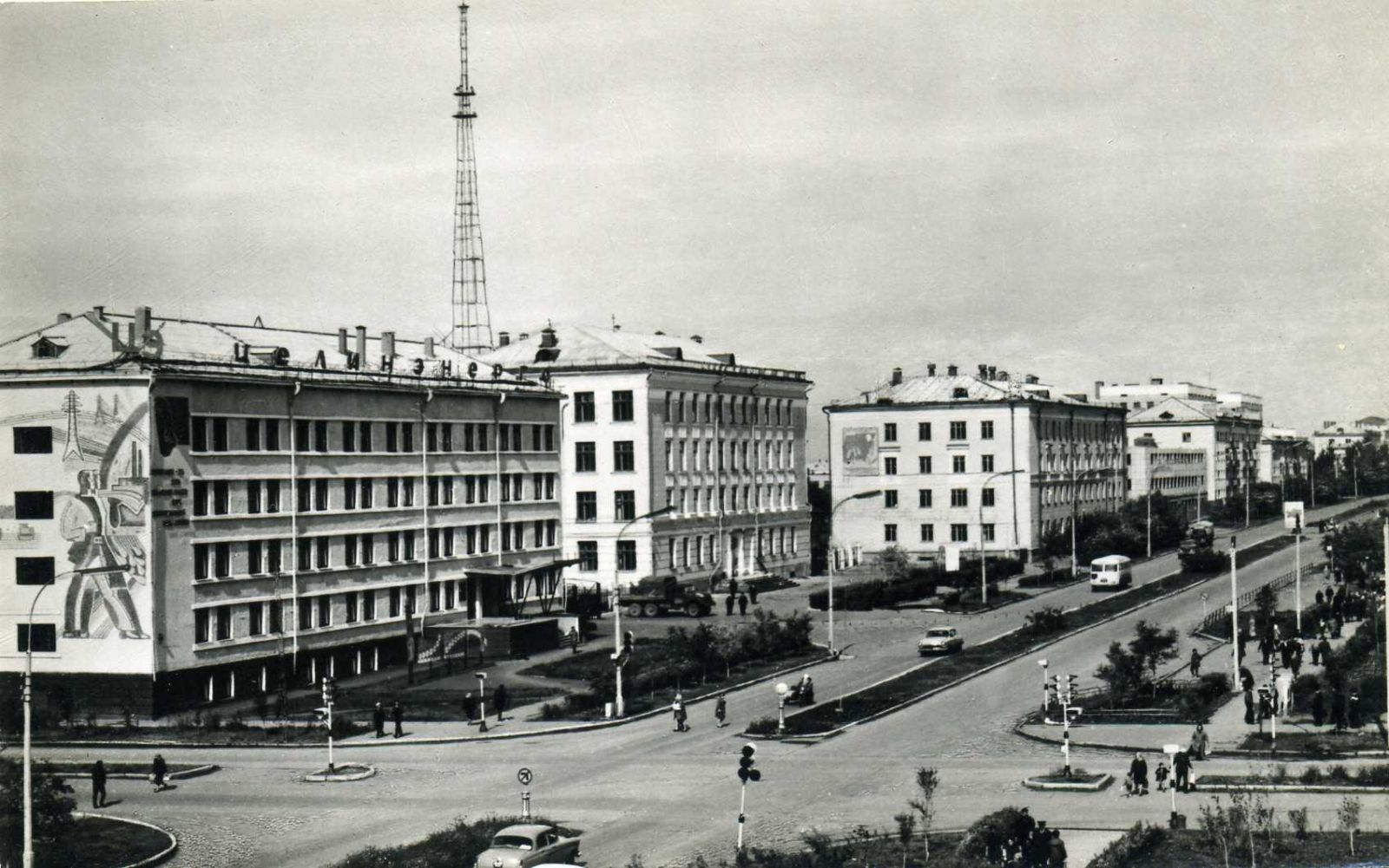
Tselinograd
In December 1960, a city with a population of one hundred thousand people becomes the center of Tselina in northern Kazakhstan. By resolution of the February-March 1954 Plenum of the Central Committee of the CPSU "On further increase in the production of grain in the country and the development of virgin and fallow lands," it was decided to master 1325 thousand hectares of virgin and fallow lands in Kazakhstan. And on March 5, 1954, young people who arrived on Komsomol vouchers delivered the first echelon to Akmolinsk.
By early 1961, the city's housing stock in Tselinograd was 600,000 square meters. m to 115 thousand people. For six months, the new builders put into operation 650 well-equipped apartments, four five-story school buildings and started building a seven-story building of the House of Soviets. By the end of 1962, the Leningraders built eight more apartment buildings and two five-story schools. During that period, the housing stock increased by another 115,000 square meters.
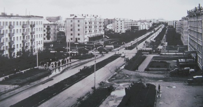
On November 6, 1963, the television center began operating in the city. At the same time, the Palace of Tselinnikov was opened, built according to the project of Latvian architects. It was designed for 2,355 seats. By scale and system of equipment at that time was considered the second in the USSR after the Kremlin Palace of Congresses.
In addition, there was finally built a bridge that connected the city with the park area, the beach and the children's railway - the main entertainment for the children of Tselinograd. The second Tselinograd bridge, transport, through Ishim (the same one, with lions and crossing steles) has its own funny story. He, strangely enough, was a long-term construction. And famous: famous humorists to the whole Union ridiculed him in the best traditions of Soviet satire.
Not far from the future bridge, where the "Samal" microdistrict now rises, the Green City of the Tselinograd students emerged. It emerged in an aggressive, as now commonly called, soil. Young people planted trees and looked after them. And not far from the Green City stood a tractor - a symbol of the virgin land. It was almost the border of the city. Next is the Salt Beam (Ak-Bulak Stream) and the steppe. The river now flows almost in the center, and the steppe has given way to microdistricts. At the gate to the old city, instead of Kirovets rose the Presidential Center of Culture. And the old car returned to the ground, to the plowed field.
The declaration of state independence of Kazakhstan has become a new historical stage in the country. The period of establishment as a sovereign state in the 90's coincided with the time of radical transformations of economic, political and social relations.
These were special years in the heat of passion and emotion. These were the years when the most important decisions were made, on which the further development of our state depended when one wrong decision could significantly change the trajectory of the country's movement as the President of Kazakhstan Nursultan Nazarbayev recalled. One of the most important events of this period was the relocation of the capital of Kazakhstan.
The strategic initiative to create a new capital belongs to the Head of State and was put forward to him in the first years of independence, in 1992. Then "the realities of the present and a whole series of geostrategic factors made us take a new approach to the process of forming our own geopolitical space." In 1994, at the meeting of the Supreme Council of the Republic of Kazakhstan, the idea of transferring the capital was first officially announced, which resulted in the adoption by the country's deputy corps of the Decree "On the transfer of the capital of the Republic of Kazakhstan".
A significant amount of documents recreating the historical retrospective of the transfer of the capital of modern Kazakhstan is contained in the National Archive of the Republic of Kazakhstan. The utmost use of this informative content allows not only to recreate the history of events but also to convey the authentic atmosphere of the historical era. Thus, the documents of the Office of the President and the Cabinet of Ministers of the Republic of Kazakhstan "The State Commission of the Republic of Kazakhstan on the redeployment of higher and central state bodies to the city of Akmola" (created by the Presidential Decree of September 15, 1995) are of particular importance for researchers of the problem of capital transfer. This fund contains correspondence of the State Commission with the Government of the Republic of Kazakhstan on the implementation of priority measures for the postponement of the capital, including: documents on the development of the State program of priority measures for the transfer of the capital of Kazakhstan from the city of Almaty to the city of Akmola.
.jpg)
Schedules for the redevelopment of the capital in Akmola, activity reports, housing need tables, tables of basic data on the relocation of ministries, costs for the reconstruction of buildings, etc. The tight schedule of redeployment are reflected in the Minutes of the meetings of the State Commission, which dealt with urgent problems of transfer, starting from the question "reducing the train time from Almaty to Akmola from 24 to 16-18 hours and increasing the frequency of its movement, organization of coordinated work of government agencies on redeployment. At the meeting of the Commission of November 11, 1995, a general list of higher and central authorities was approved for moving in the near future. Then a list of the highest and central bodies of the redeployments to be redeployed at the first stage was published, as well as a list of buildings for their deployment. In total there are 28 organizations on the list, eleven ministries, and four committees.
Astana Department of Transportation was in charge of the relocation, which arrived in the city in December 1996; however, at the initial stage transfer state employees faced with an acute shortage of housing, office space for the relocated ministries, so had to take existing buildings, to agree with the proposed options. Thus, according to First Deputy Minister of Economy J. Yertlessova: "In balance with the Research Institute of Economics at the balance during January-February 1996 a working group on the spot made the reception and transmission of the building branch of Kazakh Research Institute of Economics of the agro-industrial complex of the Ministry of Economy of the Republic of Kazakhstan. However, the issue of accommodation in the building of the oblsovprof was not resolved to the end, an agreement was reached only for the rent of the 1st floor and the assembly hall in the building of the Akmola Regional Office of the Prosecutor.
At the same time, it became obvious that the new capital required full-scale construction. In this regard, the Government instructed the State Commission in the Program of priority measures to move the capital, paying special attention to large-scale housing construction. During the development of the Program, the Akimat was instructed to within 10 days to submit to the Commission's Office data on the cost of one square meter of the total area of residential buildings built and designed this year in the city of Akmola in the context of major contractors and customers, as well as types of houses. The request was more than relevant because, in connection with the acquisition of the capital status, an increase in house prices began. If in March-April 1997, according to the regional department for appraisal and registration of real estate, the average price per square meter was $150, but in July it was already 250-300 dollars.
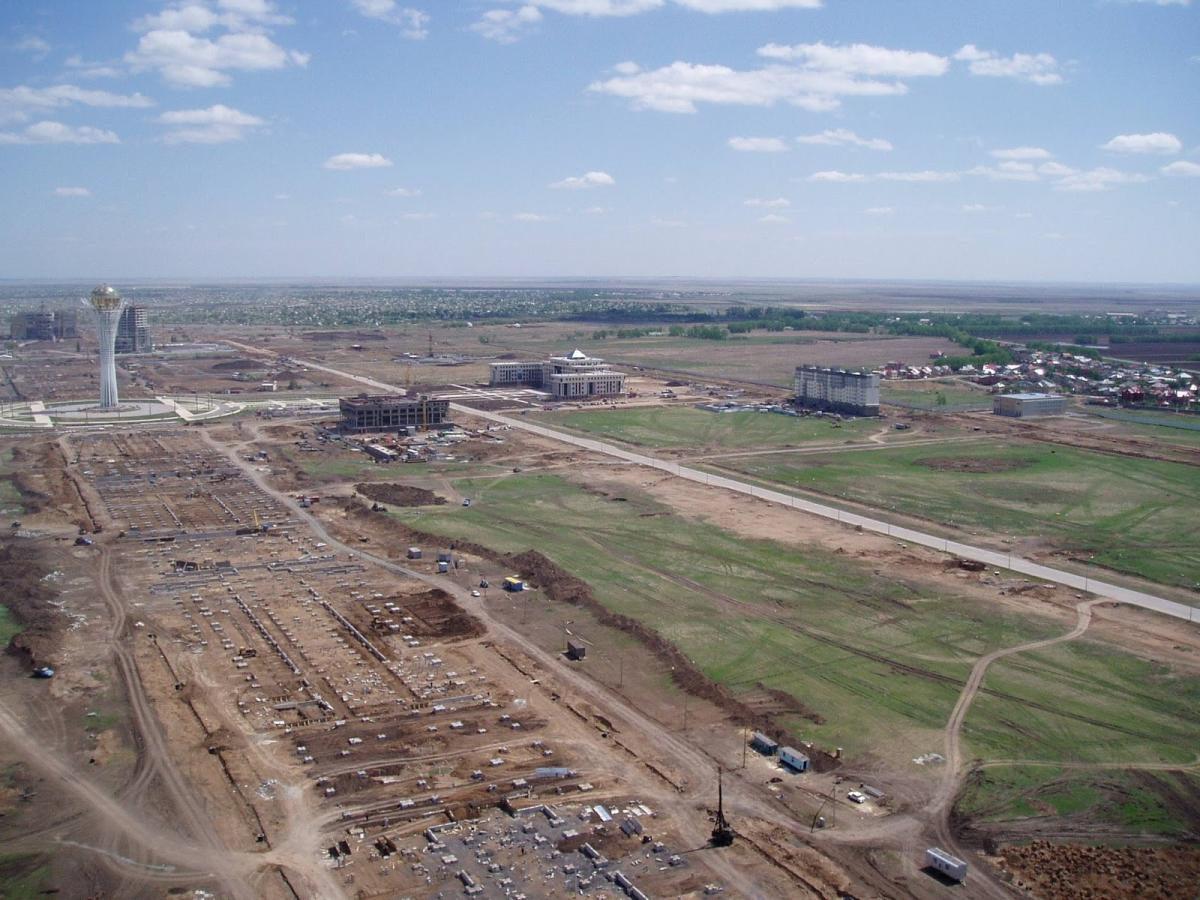
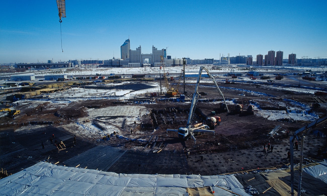
As the further course of events related to the transfer of the capital showed, for quite objective reasons already in the period 1997-2000. there was a rapid development of the former regional center, at this time the population of the city is growing rapidly, the rapid construction of the new capital is under way. As of 1998, the total land area of the city of Astana was 25.7 thousand hectares. In the general plan, the total area of land use is 71 thousand hectares. Now the task was to find a rational solution for the construction of this vast territory, which in general correspond to the grandiose scope of the planned large construction.
To solve this problem, from March 18 to December 3, 1998, an open international competition for the sketch-idea of the Master Plan for the Development of the New Center of Astana (Akmola) was held. Full archival materials "The Governmental Commission of the Republic of Kazakhstan for holding the International Competition for the Sketch-Idea of the General Plan for the Development of the New Center of the City of Akmola" include full details of the holding of this large-scale event: The program for holding an international contest, Commission for the holding of the competition, Minutes of the jury meeting of the International Competition, Consolidated conclusion of the integrated town planning expertise for the project the Study Group of the Japan International Cooperation Agency (JICA) and others.
.jpg)
50 participants from foreign countries and Commonwealth of Independent States countries showed interest in the competition. In total, 40 applications were sent. Of these, 9 were from Kazakhstan, 5 from Russia, 3 from the Czech Republic, 2 from Belarus, Ukraine, Pakistan, Kyrgyzstan, Italy, and Bulgaria. Teams sent one application from Japan, Australia, Uzbekistan, Germany, France, USA, South Korea, Great Britain, Latvia, Poland and the UAE. The following task was set before the contest participants: "In search of the image of the new center of the city of Akmola, it is necessary to find a solution corresponding to the status of the capital of the Republic of Kazakhstan, taking into account natural and climatic factors and national peculiarities."
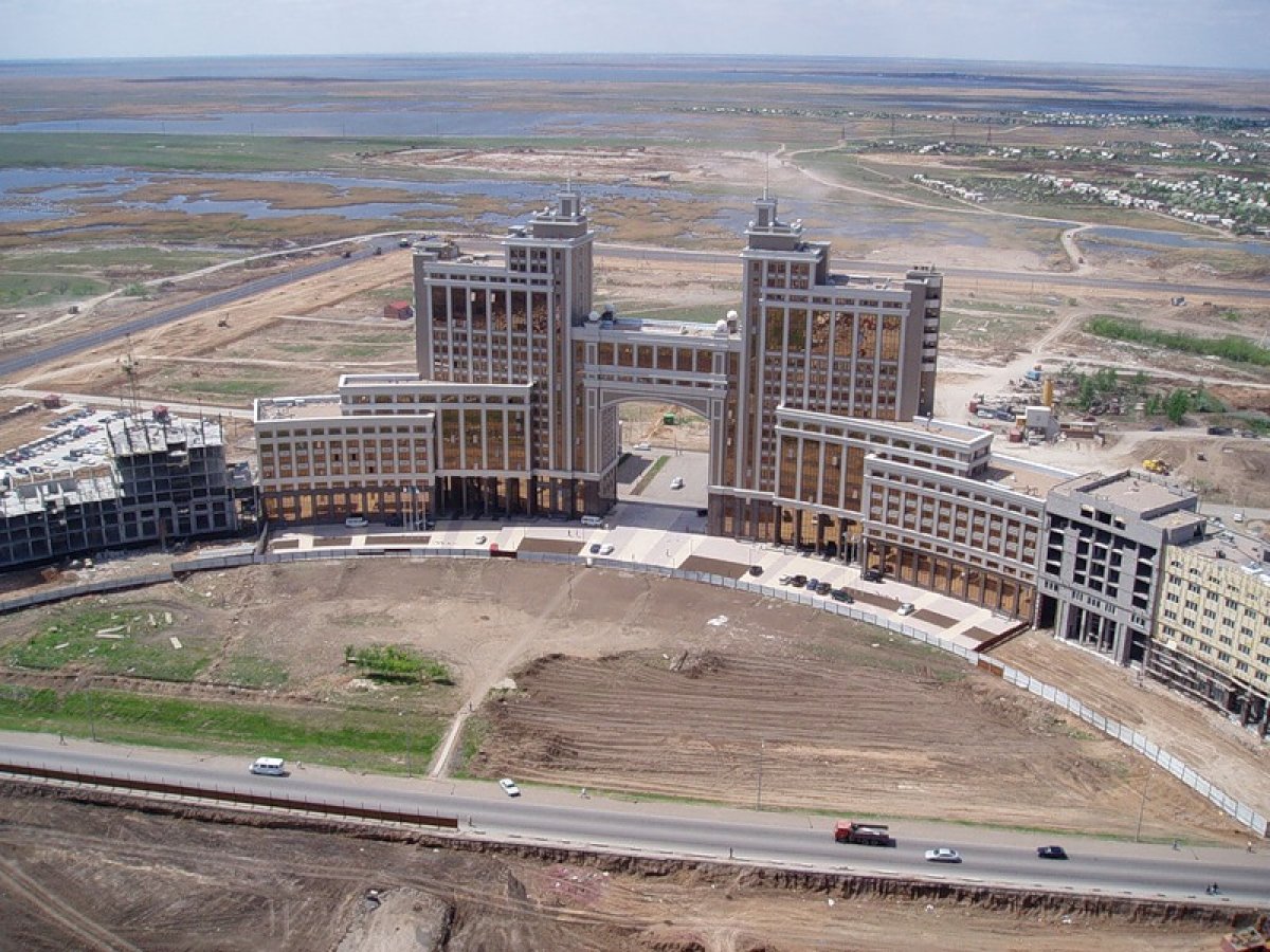
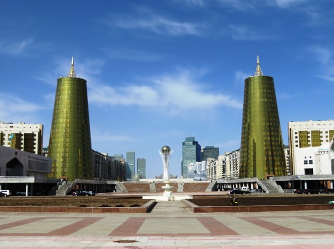
The winner of the competition was the project of the famous Japanese architect Kise Kurokawa (Kisho Kurokawa), who started the construction of the capital in the style of "Hi-tech". It was a completely different architecture, the architecture of the new XXI century. At the same time, the new capital very organically blended into the vast expanses of the steppe space, embodying the philosophical concept of the Master Plan, as a symbiotic and metabolic city. "Synthesis of the old city of Akmola and new development of the capital of Astana". Modern researchers of the problem note: "The methodological inversion of such metabolic architects as Kendzo Tange and Kisyo Kurokawa is to call to realize that there are no" eternal cities "and therefore it is necessary to concentrate on adapting to changes, and not to try to preserve the" eternal "samples of urban planning stories.
Implementation of the Master Plan highlighted the priority issues of construction, while a kind of testing ground for the implementation of architectural ideas and town planning plans, became free economic zones of Kazakhstan. The zone of active application of new technologies is the free economic zone "Astana - a new city" created in 2001.
The National Archive also contains documents and materials that recreate all the ups and downs of creating a "green belt", which was to become an important component in confronting the harsh climate of the "northern capital". Archival documents show that active work on its creation begins already in the first years of the transfer of the capital. So, on May 2, 1996, at a meeting with the Chairman of the State Commission for Relocation of State Bodies, M.N. Makievsky considered the issue: "On the allocation of land plots in the city of Akmola to the Forestry Committee for the organization of tree nurseries, forest belts and forest stands, and it was also recommended to start practical work on organizing nurseries, creating windbreak forest belts, and increasing the area of forest park plantations."
As a result, a special division of the Akim of Akmola oblast is made to divert the land to the Forestry Committee under a forest nursery of 100 hectares in the Shubary state farm in the Shubary tract bordering the state fund. The documents characterize the activities of the Forestry Committee of the Republic of Kazakhstan, which not only responsibly approached the tasks set but tried "to accelerate the solution of the issues on the creation of the green zone of Akmola." In general, as a result of purposeful activity during 1997-2016 a green zone was created, the area of which was 75.1 thousand hectares, of which 14.8 thousand hectares were located within the city limits.
The relocation of the capital put issues related to the redeployment of the Foreign Ministry and diplomatic missions in Akmola to the agenda. However, diplomats slowly moved to Akmola, fearing a severe climate. At the same time, according to archival documents, as early as in 1996, representatives of the Embassies of the Republic of Uzbekistan, Georgia, the Russian Federation and the People's Republic of China and local authorities made a choice of land plots in the city of Akmola to accommodate these diplomatic missions.

Nowadays, Astana has more than 50 embassies, consular offices and representative offices of international organizations that have diplomatic status.
The head of state stressed: "Today, most foreign embassies are located in Astana, working fruitfully to strengthen and expand bilateral relations of their countries with Kazakhstan. The move of the diplomatic corps became a collective act of international recognition of our new capital."
The idea of transferring the capital was first promulgated in 1992, a year after the popular election of Nursultan Nazarbayev is the President of the Republic of Kazakhstan, and in the shortest time, literally within 4-5 years has been implemented. During this period, during the construction of the city of Astana, an enormous amount of work has been carried out, as evidenced by archival documents that serve as a reliable source, allow us to recreate an objective and complete picture of the historical events that took place. For twenty years the new capital of Kazakhstan - Astana city has really become the center not only of Kazakhstan but of the entire Eurasian space.
